
Four of Over 40 Kanlaon Eruptions in History Occurred on June 3

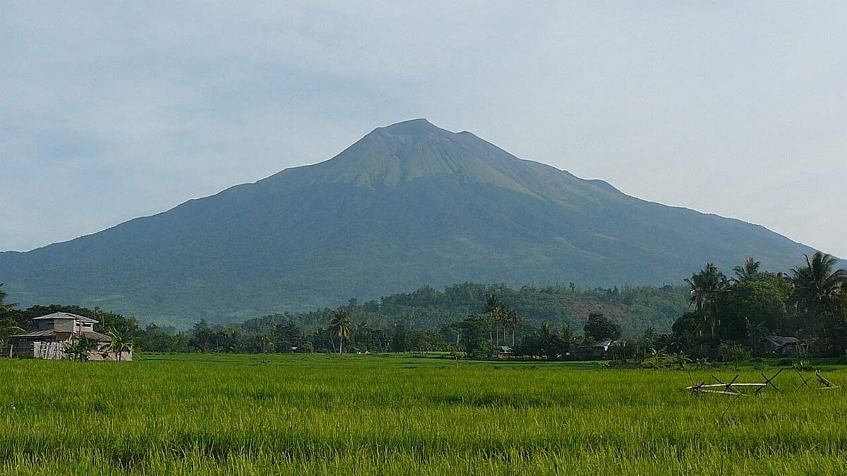
A six-minute volcanic event occurred at the summit crater of Mt. Kanlaon on Negros Island last Monday night, June 3. Alert Level 2 (Increased or Moderate Level of Volcanic Unrest) was immediately raised by the Philippine Institute of Volcanology and Seismology (PHIVOLCS). Negrenses have since faced significant disruptions and safety concerns after the "moderately explosive eruption" produced a five-kilometer-high ash column.
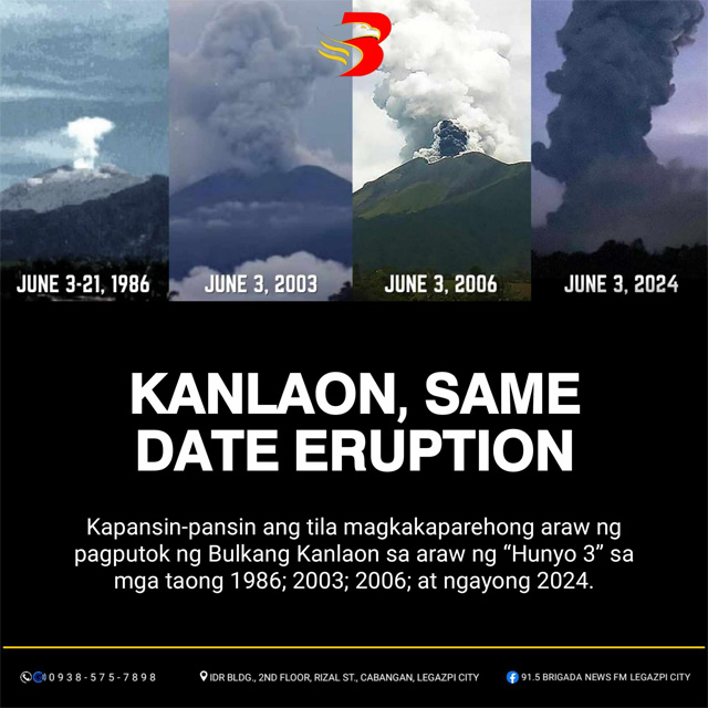
A couple of days later, a post by local radio station 91.5 Brigada News FM Legazpi City went viral after claiming that four of the over 40 eruptions of Mt. Kanlaon all occurred on June 3. "Pare-pareho naganap ng June 3 ang pagputok ng bulkan noong taong 1986; 2003; 2006; at ngayong 2024," they said in the post that has since earned more than 13,000 shares.
The seismic activity preceding the eruption was intense, with PHIVOLCS recording 43 volcanic earthquakes in the 24 hours leading up to the event. The eruption caused a strong earthquake, further complicating the situation for the local population. The ash fall and sulfuric odor have affected surrounding villages, creating health hazards and necessitating immediate evacuation measures.
Local government officials have mandated the evacuation of all residents within a three-kilometer radius of the volcano. Mayor Jose Chubasco Cardenas of Canlaon City emphasized the urgency of the situation in a video message, urging residents to move to evacuation centers and prepare essential supplies such as water and food.
The eruption has also had a significant impact on education and travel. According to Save the Children, 684 schools have been forced to close, affecting approximately 385,000 students. Nine schools have been converted into evacuation centers to accommodate displaced families. The Bacolod-Silay Airport, a crucial hub for the region, was temporarily closed, leading to the cancellation of over 60 flights and affecting more than 5,000 passengers. While the airport resumed operations by 11 a.m. on Tuesday, June 4, delays are expected to persist as the situation stabilizes.
ALSO READ
1749 Taal Volcano Eruption Detailed in Horrific Spanish Report
See Photos of the Life and Loss in Taal Volcano's Danger Zone
Mt. Kanlaon's Eruption History
Kanlaon, an active andesitic stratovolcano, is the highest mountain on the island of Negros, the highest peak in the Visayas, and the 42nd highest peak of an island in the world. It's part of the Pacific Ring of Fire, which is neither a ring nor a circle but a belt in the Pacific Region that's dotted with 75% of all active volcanoes on Earth. Roughly 90% of all earthquakes worldwide also occur in the area.
According to the report by PHIVOLCS, Kanlaon occasionally exhibits phreatic and short-lived explosive eruptions that produce small-magnitude hazards. It was only the 1902 eruption that was magmatic, where a small volume of lava flowed on the upper slopes. The agency's data shows up to 43 recorded eruptions since 1866, and as claimed by 91.5 Brigada, four of them happened on June 3.
- The first June 3 eruption was recorded in 1986 as a phreatic eruption that ran from June 3 to 21, 1986.
- The second June 3 eruption happened in 2003, with noted dates including June 1, June 3 to 4, June 7 to 14, and June 17 to 18. This was followed by other phreatic eruptions in July 2003.
- The year 2006 also saw a June 3 phreatic eruption with other recorded dates, including June 10, June 12 to 15, June 19, June 21 to 24, and more dates in July 2006.
- Finally, there's the June 3, 2024, volcanic incident, which—as of the moment—is classified as an "explosive eruption."
In a press conference last June 4, PHIVOLCS said that they're still assessing if what happened is phreatic or magmatic.
"Sa atin pong review, hindi tayo sigurado kung phreatic because of the strength of the eruption which was recorded by all seismic stations of Kanlaon volcano, and then we also witnessed incandescence," PHIVOLCS Volcano Monitoring and Eruption Prediction Division chief Antonia Bornas said.
Dates of All Recorded Kanlaon Eruptions Before June 3, 2024
- 2017 Dec 20 2:33 AM
- 2017 Dec 9 9:47 AM
- 2016 Jun 18 9:19 AM
- 2016 Mar 29 6:20 PM
- 2015 Dec 27 1:29 PM
- 2015 Dec 24 9:09 PM
- 2015 Dec 23 2:57 PM
- 2015 Dec 15 9:38 PM
- 2015 Dec 13 10:08 AM
- 2015 Dec 13 9:51 AM
- 2015 Dec 12 1:01 PM
- 2015 Dec 12 11:40 AM
- 2015 Dec 11 - 05:13 AM
- 2015 Nov 23
- 2006 Jun 3,10,12-15, 19,21-24, Jul 1,3,23,25
- 2005 Jan 21, Mar 20,24,30-31, Apr 2-3,7-17, May 25
- 2003 Mar 7,17, Jun 1,3-4,7-14,17-18, Jul 1,3-4,10-11,13-14,19-20,23
- 2002 Nov 28
- 1996 Aug 10,13,16,27, Sept 3
- 1993 Aug 25, Sept 3
- 1992 Jan 8, Jun 10
- 1991 Feb 13
- 1989 Oct 25 - Nov 17, Dec 1
- 1988 Jun 21
- 1987 Apr 24
- 1986 Jun 3-21, Aug 18
- 1985 Mar 13-14, Nov 2
- 1978 Mar 22-Sept 2
- 1969 Oct 10-29
- 1932 Dec 23-1933 Jan 6
- 1927 Mar 20
- 1906 Jan 16, Nov 6
- 1905 Nov 6
- 1904
- 1902 Jan 31
- 1898 Jun
- 1894
- 1893
- 1884 May-Jun
- 1883 Jul
- 1881
- 1866
Kanlaon’s last phreatic eruption was in December 2017, while its last magmatic eruption was 122 years ago in 1902.
What's the relation of June 3 with Mt. Kanlaon's eruptions?
The four volcanic activities that all happened on June 3 out of the 43 eruptions of Mt. Kanlaon make up only 9.30% of recorded data. Also, out of the 43 entries, only eight occurred in June, which makes up about 18.60%. These percentages are too small to merit a pattern, and it can be assumed that it's just a coincidence.
The season—in this case, the tail end of the dry season and the start of the wet season in the Philippines—does not play a part in the predictability (or unpredictability) of a volcanic eruption. The weather's role mostly affects post-eruption occurrences, such as the fact that rainfall mixed with ash result in a destructive lahar that ravages towns.
Generally, monitoring of volcanic activities happens under us and not above us. These include monitoring seismic activity, ground deformation, gas emissions, and changes in volcanic lakes. Seismic activity, or the frequency and intensity of earthquakes in a volcanic region, often increases before an eruption. This is because magma moving towards the surface causes rocks to crack and shift, producing detectable seismic waves.
However, research made by scientists in Florida and published in Nature on April 22, 2020, concluded that extreme rainfall triggered the 2018 eruption of Kilauea Volcano in the Hawaiian Islands. They noted that the "rift intrusion" was preceded by several months of prolonged periods of heavy rainfall, which could have found its way through the pores of the volcanic rock and increased the pressure within Kilauea Volcano.
"We knew that changes in the water content in the Earth's subsurface can trigger earthquakes and landslides. Now we know that it can also trigger volcanic eruptions. Under pressure from magma, wet rock breaks more easily than dry rock. It is as simple as that," Falk Amelung from the University of Miami’s Rosenstiel School of Marine & Atmospheric Science said.
In addition, scientists around the world are also theorizing that the climate crisis may affect volcanic eruptions, either compounding a volcano-related event with a climate-related event or climate change directly triggering a volcanic eruption. Wildfires, floods, landslides, and drought that coincide with volcanic eruptions can definitely affect a community gravely. Then, there's the idea that extreme natural disasters can also affect the geology surrounding volcanic sites.
"Sea level rise, glacial melting, aquifer depletion, and mountain erosion can all affect the likelihood and frequency of volcanic eruptions," explained volcanologist Jonathan Fink from Portland State University.