NOAH Website From 2012 Still Maps Out Flood Hazard Level

As a country lying directly on the path of the typhoon belt in the northwestern Pacific Ocean as well as the Pacific Ring of Fire, the Philippines is no stranger to natural disasters. Up to 60 percent of its land area and 74 percent of its population are exposed to floods, cyclones, droughts, earthquakes, tsunamis, and landslides, according to the Climate Change Knowledge Portal. Therefore, disaster preparedness is always sought after when it comes to calls for policy changes and other campaigns.
One of these is Project NOAH (Nationwide Operational Assessment of Hazard), which was launched by Filipino geologist and project head Mahar Lagmay in 2012 as the Philippines' primary disaster risk reduction and management program under the Department of Science and Technology (DOST). It was officially defunded by the government in 2017, but it was later adopted by the University of the Philippines. Its website is still accessible and able to show the probability and assessment of various areas in the Philippines in terms of Flood Hazard Level, Landslide Hazard Level, and Storm Surge Hazard Level. These are based on previous models of natural disasters in the Philippines.
ALSO READ
Project Noah Was Once Vital For Disaster Prevention and Rescue. The Government Defunded It
How to Stay Safe During a Flood
How to Use the NOAH Website
NOAH is accessible via noah.up.edu.ph. Its landing page lets users enter the area of concern through a geolocation prompt.
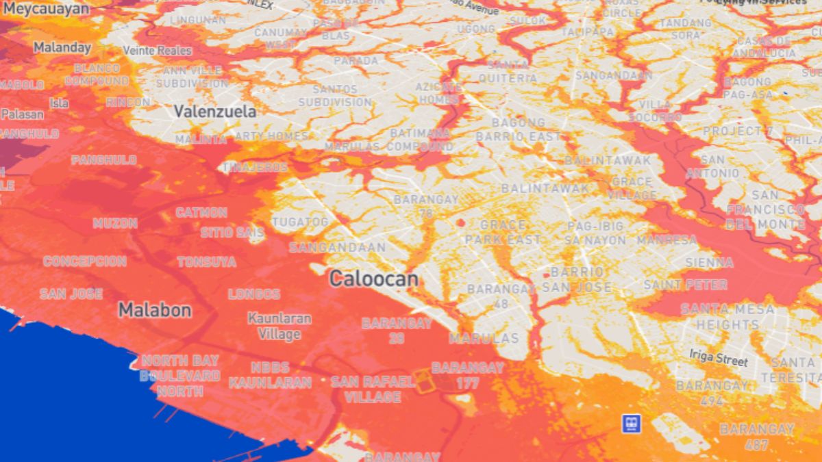
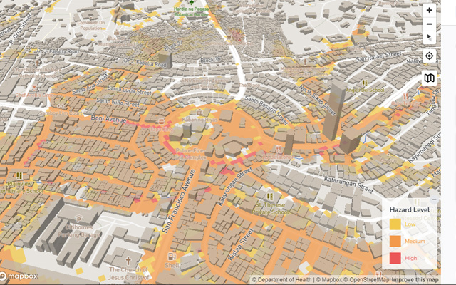
After putting in a location, the screen shows a map with hazard levels based on display color: yellow for low, orange for medium, and red for high. It also shows whether this hazard is due to flood, landslide, or storm surge. The hazard levels are based on flood simulations as well as satellite and historical data.
The site also lists down critical facilities in the indicated area, including health centers, fire stations, schools, and police stations.
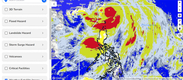
A real-time weather satellite image can be accessed via the NOAH Studio tab.
History of Project NOAH
Project NOAH was launched as a response to former President Benigno Aquino III's call for better disaster prevention and mitigation, especially after the 2011 Tropical Storm Sendong that damaged nearly 40,000 homes and claimed more than 1,000 lives.
Project NOAH was a comprehensive effort to harness advanced technology and scientific research to enhance the country's resilience to natural hazards. It involved the deployment of state-of-the-art weather monitoring equipment, the development of high-resolution flood hazard maps, and the creation of a centralized data platform accessible to the public. These initiatives significantly improved the accuracy of weather forecasts and flood warnings, enabling communities to better prepare for impending disasters.
One of the standout features of Project NOAH was its real-time weather monitoring system. This system provided up-to-the-minute data on weather conditions across the country, which was crucial for early warning and timely evacuations. The project also developed a suite of mobile applications that allowed users to access weather updates, flood forecasts, and hazard maps on their smartphones, making critical information readily available to the public.
The Shut Down of Project NOAH
In January 2017, the Philippine government announced that it was pulling the plug on Project NOAH by March 1, 2017, citing a lack of funds.
"There are a lot of government funds or disaster risk reduction [pero] wala lang po for Project NOAH after February 28. We were told verbally that our request for extension will not be approved," Lagmay told GMA News Online back then. Scientists and researchers working on the project also experienced salary delays for up to four months.
On June 20, 2017, Project NOAH was officially adopted and relaunched as NOAH Center by the then newly-established University of the Philippines Resilience Institute (UPRI). This ensured its valuable work would continue under the stewardship of one of the country's premier academic institutions. This transition marked a new chapter for the project, as it continued to evolve and expand its capabilities in disaster risk reduction and management. But while the NOAH website is still online, its value as a disaster preparedness program used by local government units just isn't the same.
According to a 2020 Philstar.com interview with Lagmay, who's also the director of UPRI, Project NOAH's biggest contribution is "hazard-specific, area-focused and time-bound warnings." Back when it was still funded and operated by DOST, they did pre-disaster risk assessment hand in hand with the National Disaster Risk Reduction and Management Council. Information was given at an LGU level. "Mayors have been telling us it was useful to them," he added in the Philstar.com interview. As part of DOST, information was made official and relayed nationwide.
While UPRI and Project NOAH (now NOAH Center) share the same vision, "it's different if you're part of a system that is official," Lagmay continued.
Now, NOAH Center stands as "a research center for climate actions and disaster risk reduction and management" and serves as the flagship program of UPRI, which has a "mission is to empower local communities through multidisciplinary actions toward resilience," according to the UPRI website.
What it lacks in the deployment of real-time sensors, it makes up for by crowdsourcing real-time information.
NOAH and Crowdsourced Information
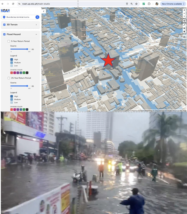
Amid the deluge of Typhoon Carina on July 24, 2024, Lagmay requested online users to take photos of flooding in the area and contribute to future flood models.
"Assignment po sa mga nasa bahay at naiinip. Baka puwede niyo po gawin ito tapos ipost sa Facebook/Twitter. We will archive your posts for validation purposes and future use in disaster risk reduction efforts of the country. Please tag UP NOAH," he said in a post.

There were also questions about the return of the NOAH app, which Lagmay said is still under development.