
Today I Learned: Why Sinkholes Appear After a Quake

On the evening of September 30, 2025, an earthquake with a magnitude of 6.9 hit the northern part of Cebu, shaking homes, destroying important infrastructure, and leaving communities devastated.
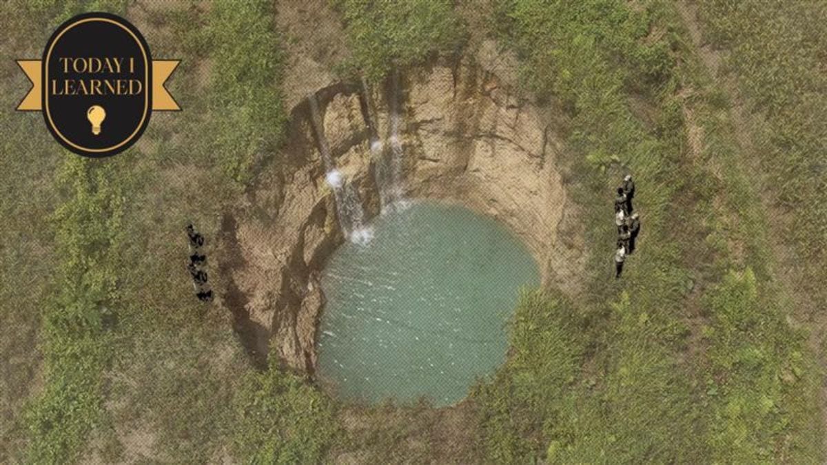
Aside from the quake, another problem quietly emerged: sinkholes, which became evident in the municipalities of Daanbantayan, San Remigio, and Medellin. The once-solid land had softened underneath, threatening the surface.
In Daanbantayan, residents discovered a four-meter-deep void in Sitio Mayjo. The Mines and Geosciences Bureau (MGB) teams subsequently confirmed additional sinkholes and cases of land subsidence across other northern Cebu municipalities. In San Remigio alone, local reports noted at least 15 sinkholes in Sitio Maño, Barangay Maño, following the earthquake.
In Siquijor, southeast of Cebu, residents have reported sinkholes appearing in rice paddies, including one in Sitio Pilapil, Barangay Napo, San Juan, containing seemingly pristine water.
What Are Sinkholes and How Do They Form?
Sinkholes aren’t magical portals or the work of mischievous spirits. They’re shaped by natural forces—geology, water, and the stress that builds up underground. Over time, hollow spaces can form in limestone or dolomite rock, and when their support weakens, the ground above can suddenly collapse. Earthquakes can act as a trigger: they shake loose rock and sediments, widen fractures, and weaken structural support, causing the ground above to collapse.
The Philippine Office of Disaster Risk Reduction and the MGB broadly define sinkholes as “depressions or holes in the ground caused by the dissolution, collapse, or erosion of rock below the land surface.”
Once the ground gives way, the impact is felt far beyond the sinkhole itself. Economic damage can be immediate: farmland is lost, buildings are compromised, and infrastructure is threatened. Local authorities are left with difficult choices—whether to close off zones, relocate people, assess compensation, or hope the cracks don’t spread.
A sinkhole is not always an isolated event. Beneath many Philippine islands, especially in the Visayas, subterranean caves, fissures, and water channels may lie unmapped. During earthquakes, the surrounding ground can be destabilized even if it hasn’t yet collapsed.
Consider past events: after the 7.2-magnitude Bohol earthquake in 2013, nearly a hundred new sinkholes appeared across nine municipalities. In Negros Oriental, four sinkholes emerged the day after a quake struck a rural village, prompting evacuations.
Since PHIVOLCS has determined that the recent earthquake originated from the Bogo Bay Fault, Philippine scientists are now monitoring for patterns and keeping a close watch on how the ground beneath us is shifting. The earth’s crust is always in motion, building up pressure deep below the surface, even if we don’t see or often feel it. This means that areas that appear calm and seemingly unaffected right now may unknowingly develop cracks or ground movement in the future as that pressure continues to build. In simple terms, the land is still adjusting after the quake, and nearby areas could also be affected over time.
ALSO READ
Today I Learned: Why Timog Is 'Timog,' and Not South Avenue
Today I Learned: The History of the Multi-Billion Peso ‘Payanig sa Pasig’ Lot
Staying Prepared
Moving forward will require more than quick repairs—it calls for caution, science, and coordination.
For geotechnical mapping and surveys, municipalities should work closely with the MGB, PHIVOLCS, and academic institutions to chart what lies beneath—subsurface voids, soil stability, and hazard zones that could spell danger in the next tremor.
Under risk zoning and signage, affected barangays should be clearly marked, with visible warnings and cordoned areas—people shouldn’t casually walk through spots where the ground might give way.
When it comes to evacuation and relocation readiness, the worst-case areas should already have plans in place to move vulnerable residents to safer ground. For infrastructure audits, roads, water lines, sewerage systems, and even electric poles may now rest on shifting soils; inspections and reinforcements can’t wait. And in public education, communities need to know the warning signs—cracks, pooling water in odd places, sudden ground depressions, or unexplained tilting.
The sudden appearance of sinkholes across the Philippines is a reminder of how fragile our relationship with the land truly is. Beneath familiar landscapes, the ground continues to shift—often in ways we can’t see.