• Man at His Best 2025
  • Long Reads
  • Style
  • Money
  • Wheels
  • Culture
  • Opinion
  • CORNER OFFICE
Search
Menu
Close
Close
  • Man at His Best 2025
  • Long Reads
  • Style
  • Money
  • Wheels
  • Culture
  • Opinion
  • Style
    • Fashion
    • Grooming
    • Watches
  • The Good Life
    • Pursuits
    • What She Wants
    • Mavericks
    • The Directory
    • The Noble Man
  • Culture
    • Food & Drink
    • Arts & Entertainment
    • Lifestyle
    • Tech
    • Movies & TV
    • Music
    • Books & Art
    • Design
  • Wheels
    • Cars
    • Motorcycles
    • Drive
  • Money
    • Industry
    • Wealth
    • Capital
    • Movers
  • Long Reads
    • Notes & Essays
    • ESQ&A
    • What I've Learned
    • Fiction
    • Features
  • Life
    • Sports
    • Health & Fitness
    • Women
    • Sex & Relationships
    • Travel
  • Politics
    • Opinion
    • News
  • COUPONS
  • About Us
  • Terms of Use
  • Privacy Policy

NPC Seal of Registration

Esquire has been granted the NPC Seal of Registration in recognition of the successful registration of its DPO and DPS

© 2026 EsquireMag.ph, All Rights Reserved
Life

Jeju, South Korea: The Island Forged Twice by Fire

By Christa I. De La Cruz
Oct 22, 2025

The image of fire persists in the history of Jeju, the southernmost province of South Korea. This region, particularly Jeju Island, is now a popular tourist destination and a visa-free haven for Philippine passport holders, visited for its temperate climate, picturesque beaches, and stunning natural scenery.

This beauty, however, is literally and historically forged in fire. The island itself is a landmass born of volcanic eruptions that began two million years ago. Fire would later become a harrowing symbol of the Jeju April 3rd Uprising and Massacre in the 1940s and '50s, when government counterinsurgency efforts resulted in whole villages being razed to the ground and innocent civilians being killed. Today, the island's natural wonders—from its unique basalt rocks and tuff rings (a.k.a. volcanic landforms)—stand alongside its memorial parks, with both serving as a testament to its past.

But how, exactly, was this majestic and tragic land of fire originally formed?
ADVERTISEMENT - CONTINUE READING BELOW
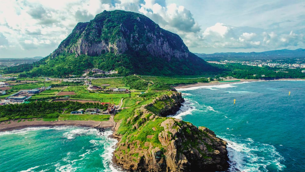
Jeju Island
Adobe Stock

ALSO READ:

You Can Now Travel Visa-Free to South Korea's Jeju Island and Yangyang

South Korea Travel: Explore Seoul on a Budget for 7 Days

The Fire of Creation

The Jeju Island we see today was shaped by four distinct stages of volcanic activity, complemented by the continuous weathering and erosion of its coastline. This geological process began with an initial underwater eruption approximately two million years ago, which created the Seoguipo Formation. This was followed by the formation of a large lava plateau and distinct peaks some 700,000 years ago, leading eventually to the birth of the island's central and highest point, Hallasan Mountain, about 100,000 years ago. The final stage involved lateral eruptions that formed the numerous smaller volcanic cones (oreums) scattered across the island some 25,000 years ago.

CONTINUE READING BELOW
watch now

As an island born of fire, Jeju's present-day dramatic landscape boasts towering tuff cones rising out of the ocean, dark-colored lava walls, and a complex system of low-temperature lava caves. These unparalleled geological features are precisely why the UNESCO World Heritage Convention inscribed the Jeju Volcanic Island and Lava Tubes in 2007. The UNESCO World Heritage Site comprises three distinct components: the Geomunoreum lava tube system, the fortress-like Seongsan Ilchulbong Tuff Cone, and Mt. Hallasan.

Jeju Island is the only place where all four Internationally Designated Areas occur at the same location. Aside from a World Heritage Site title, it's also a Biosphere Reserve, a UNESCO Global Geopark, and home to two Ramsar wetland sites (1100 Altitude Wetland and Muljangori-Oreaum Wetland). The island has four major ecosystems of biogeographic regions: alpine coniferous forest, temperate broadleaf forest, warm temperate evergreen lucidophyll forest, and temperate grassland, which host diverse flora and fauna, including up to 90 Jeju endemic plants, 28 of which are found on the summit of Mt. Hallasan.

ADVERTISEMENT - CONTINUE READING BELOW

These spectacular natural wonders are now some of Jeju's most celebrated and accessible attractions that can be visited via DIY trips or day tour packages.

Handam Coast Trail
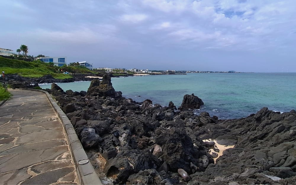
Handam Coast Trail
Christa I. De La Cruz

The Handam Coast Trail, also known as the Gwakgeum Olle Trail, is a 1.2-kilometer boardwalk that winds through cooled and hardened lava rocks on the west side of Jeju Island.
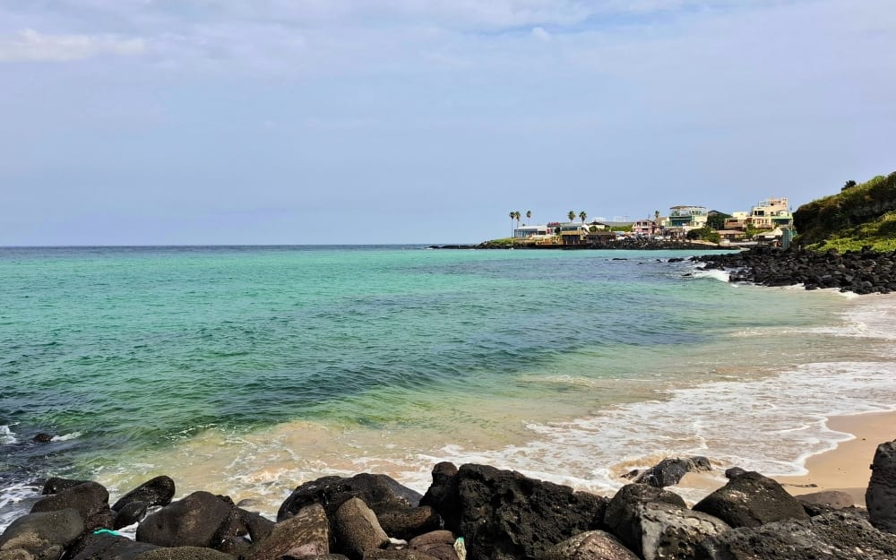
Handam Coast Trail view
Christa I. De La Cruz

It makes for a good running or walking route, with the trendy northwestern town of Aewol featuring cool cafes and restaurants on one end and the family-friendly Gwakji Gwamul Beach on the other.

ADVERTISEMENT - CONTINUE READING BELOW

The Handam Coast Trail is in Gwakji-ri, Jeju-si, Jeju-do. It is open 24 hours. Admission is free.

Suwolbong Peak Geo Trail
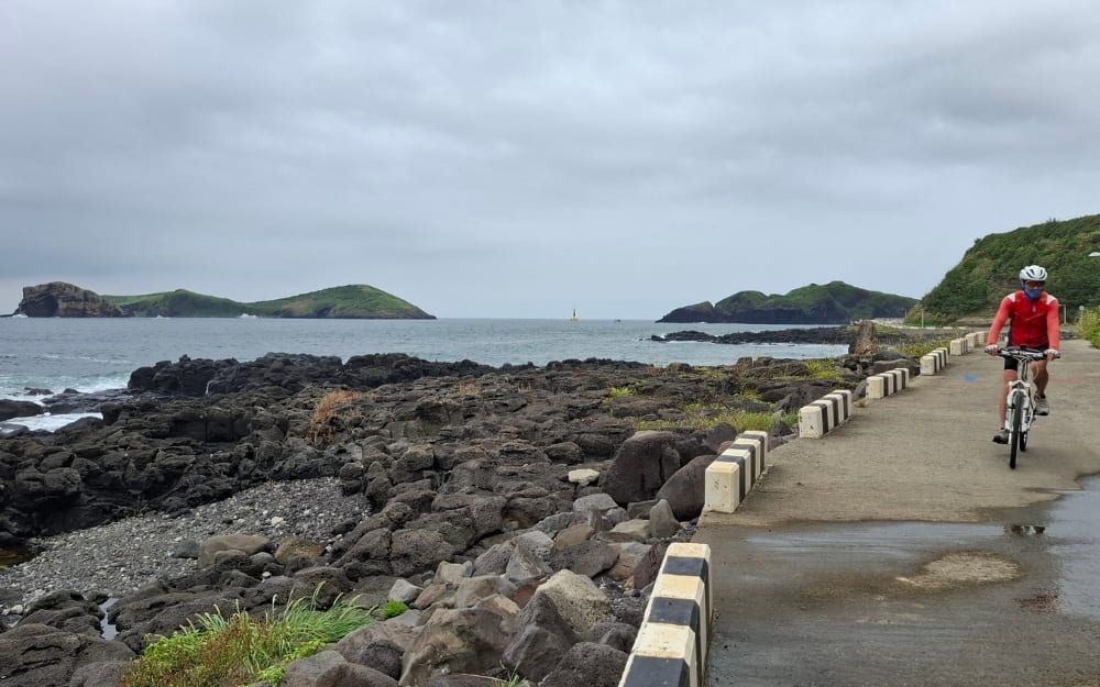
Suwolbong Peak Geo Trail walk
Christa I. De La Cruz

Also found on the west is Suwolbong Peak Geo Trail, which is probably the best way to experience Jeju Island as a UNESCO Global Geopark. It allows visitors to closely observe ash layers on one side as well as black-colored hardened lava on the other. Find out how, 18,000 years ago, a hydromagmatic eruption—the interaction of rising hot magma and water—produced the Suwolbong Tuff Ring.
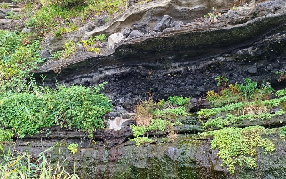
Suwolbong Peak Geo Trail volcanic tuff cone
Christa I. De La Cruz

During the Pacific War, the Japanese army established military facilities at about 120 oreums on Jeju Island. Suwolbong, in particular, has several tunnels that store ammunition as well as suicide boats.
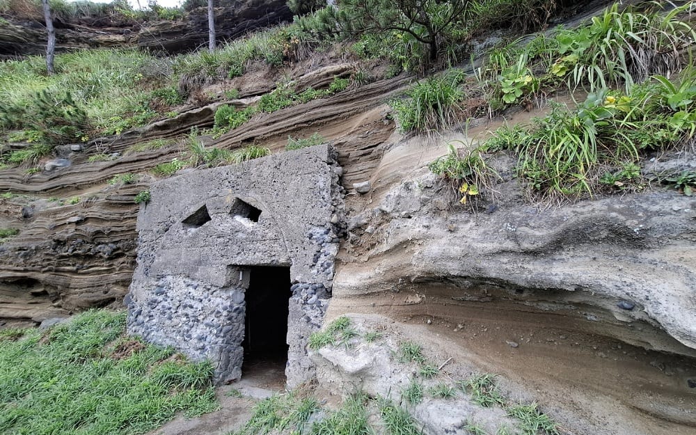
Suwolbong Peak Geo Trail tunnel
Christa I. De La Cruz

Think of it as a textbook on volcanology, except you're getting your steps in, taking photos for your social media, and reading bits of trivia that may or may not be of use during quiz nights. The trail's highest point is the Suwolbong Peak, which is a small oreum that's 77 meters above sea level. There you can find a small pavilion called Suwoljeong, which has front-row seats to a view of Chagwido, Songaksan Mountain, and Jukdo Island.

The Suwolbong Observatory on Suwolbong Peak
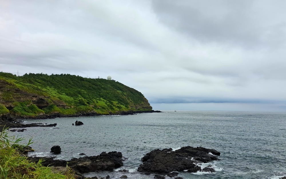
Suwolbong Peak Geo Trail observatory
Christa I. De La Cruz

The Suwolbong Peak Geo Trail is in Noeulhaean-ro, Jeju-si, Jeju-do. It is open 24 hours. Admission is free.

Hwansangsup Forest Gotjawal Park
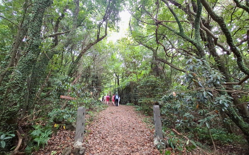
Hwangsang Forest trail
Christa I. De La Cruz


Given its geologic history, Jeju Island's forests are home to primeval ecosystems, which means they're diverse and densely packed with a variety of giant ferns, trees with massive and exposed roots, and moss-covered rocks. Think Jurassic Park. Of course, if we're strict about it, Jeju Island was formed during the Pleistocene Epoch (a.k.a. Ice Age) under the Cenozoic Era, which is millions of years after the Mesozoic Era's Jurassic Period.

Anyway, what's interesting about Jeju's forests is that they're formed on lumpy basalt, which are dark volcanic rocks formed from the rapid cooling of lava. What was once a hot, glowing liquid eventually turned into hard black rocks, from where diverse flora grew.
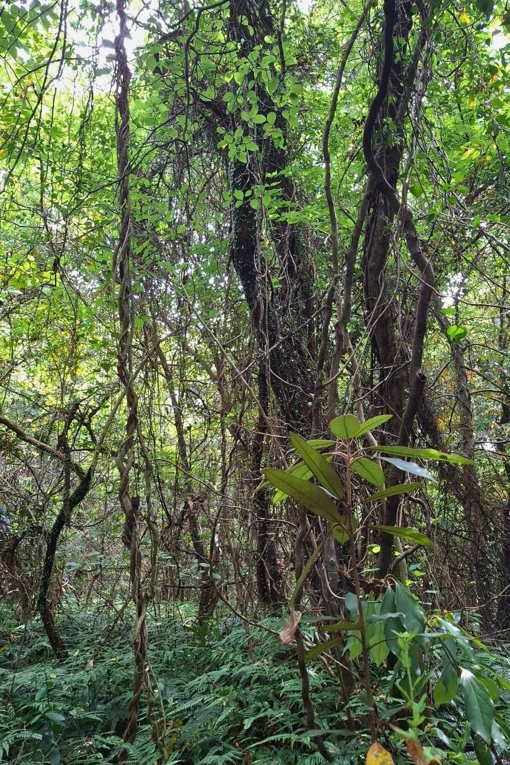
Hwangsang Forest
Christa I. De La Cruz


One of these is the Hwansangsup Forest Gotjawal Park, which is most famous as the filming location of BTS' The Most Beautiful Moment in Life album cover. There's a self-guided walking trail of 1.2 kilometers—just follow the arrows; and a guided walking trail of 600 meters. 

Hwansangsup Forest Gotjawal Park is in Nokchabunjae-ro, Hangyeong-myeon, Jeju-si, Jeju-do. It is open from Monday to Saturday, from 9 a.m. to 6 p.m.; and every Sunday, from 1 p.m. to 6 p.m. Admission fee (including a guided tour) is 5,000 won.

Cheonjeoyeon Falls
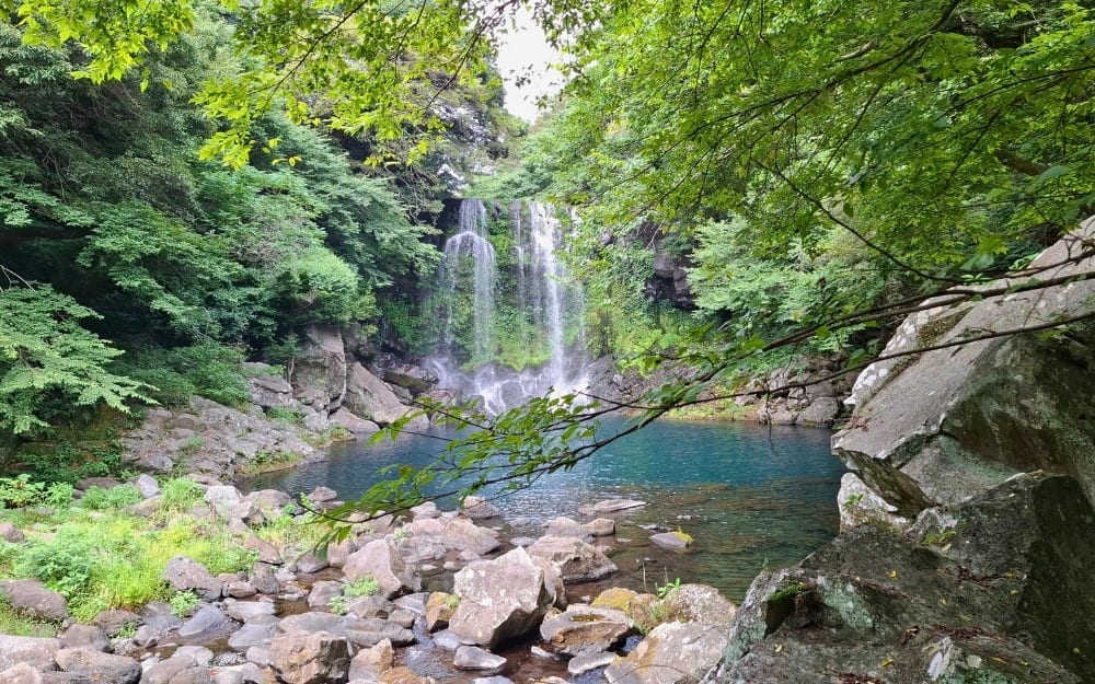
Cheonjeoyon Second Waterfalls
Christa I. De La Cruz


Cheonjeoyeon, a three-tier waterfall, is enriched by a folklore about seven nymphs who descended from the heavens at night to bathe in the pond. Because of this, it is believed that standing under the falls on the 15th day of the seventh lunar month can cure diseases. Swimming is now prohibited, however, for safety reasons. Still, it's calming to just be in awe of the sights. It was designated a Natural Monument in 1993 because of the rare plants found in the warm temperate forest surrounding the waterfalls.
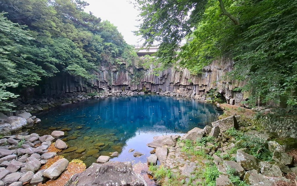
Cheonjeoyon First Waterfalls
Christa I. De La Cruz


The first waterfall, which is only 200 meters from the entrance, flows only after heavy rain. The second stop, which is 300 meters downstream, can be reached by rocky steps. The third waterfall is 500 meters from the second waterfall. Between the second and third is the Seonimgyo Bridge, which is about 128 meters long and 78 meters high. The iron bridge is decorated with the seven nymphs from the local myth.
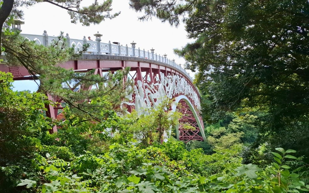
Bridge in Cheonjeoyon
Christa I. De La Cruz


Cheonjeoyeon Falls is in Cheonji-dong, Seogwipo-si, Jeju-do. It is open daily from 9 a.m. to 10 p.m. Admission is 2,500 won.
article big image
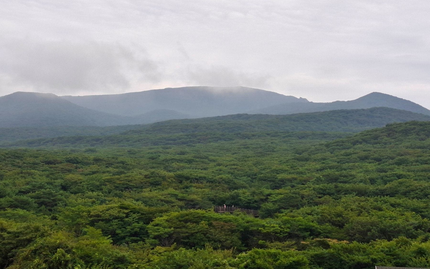
View of the 1100 Altitude Wetland from the 1100 Highland Rest Area
PHOTO: Christa I. De La Cruz

1100 Altitude Wetland

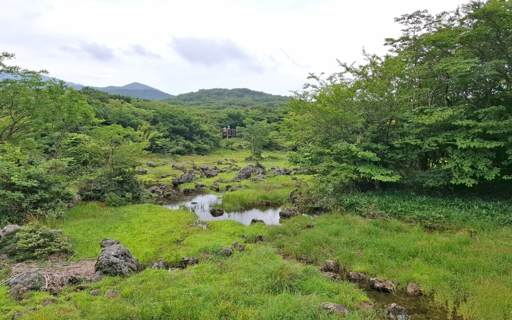
Jeju's 1100 Altitude Wetland, as the name suggests, is located 1,100 meters above sea level within the Mt. Halla World Heritage Site. It is easily accessible by Jeju's highest road that connects Jeju City and Seogwipo. This volcanic wetland is a Ramsar site, which means it was designated to be of international importance under the Ramsar Convention—the Convention of Wetlands signed in Ramsar, Iran.

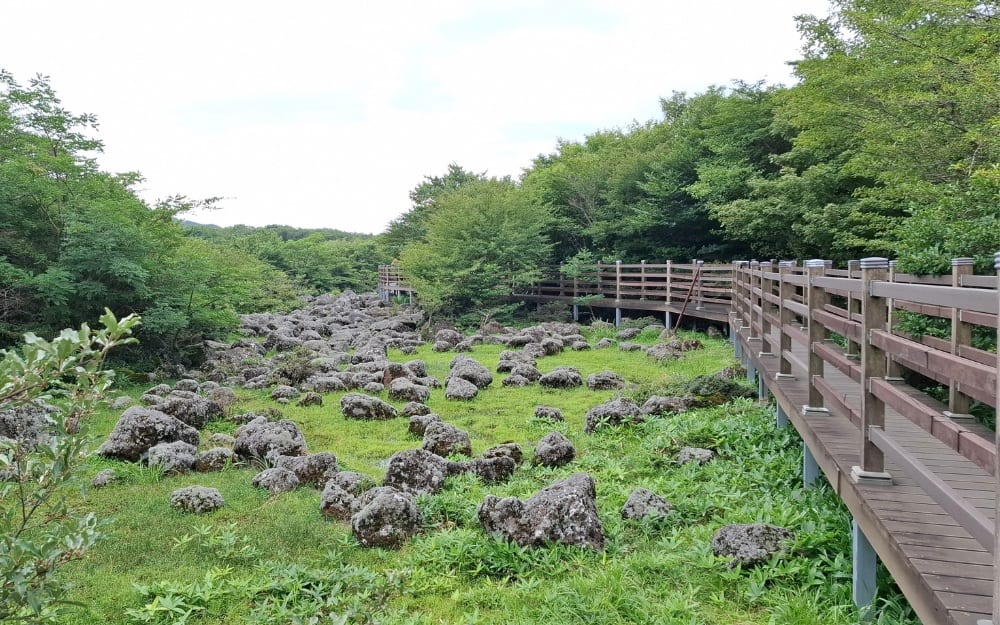
1100 Wetland Deck
Christa I. De La Cruz

1100 Wetland
Christa I. De La Cruz

It features freshwater marshes and pools, which can be explored by walking through a wooden deck—some of which were made from recycled wood. This 675-meter Discovery Trail also bears signages (with pictures!) that describe the kinds of wild animals, wild flowers, and other natural vegetation that live in the wetland. Across the trail is the 1100 Highland Rest Area, which has a convenience store and a view deck with binoculars.

1100 Altitude Wetland is located on Highway 1139 in Saekdal-dong, Seogwipo-si, Jeju-do.

Micheon Cave, Ilchul Land

Micheon Cave entrance
Christa I. De La Cruz

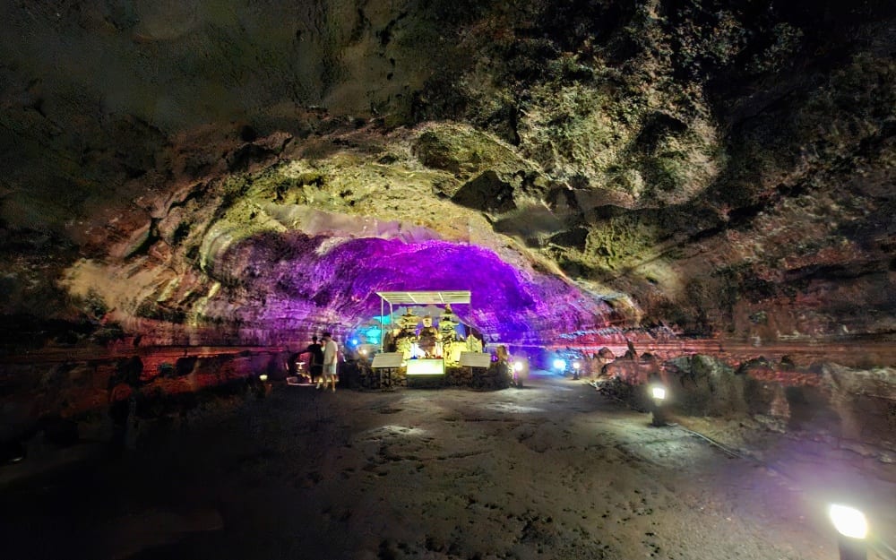
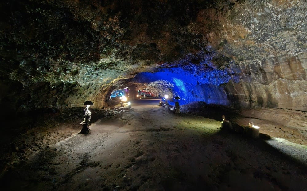
Micheon Cave, often the first stop during an eastern tour, is a 25,000-year-old cave and one of the 15 cave systems on Jeju Island. It is 1,700 meters long, but only 365 meters is accessible to the public. Water continuously seeps in, making it significantly cooler inside the large-scale cavern even during the hot summer months. In 2017, colored lights and installation art were placed inside the cave as part of the attraction.

Media artist and sculptor Young-Hoon Jeong and Creative Director Sun Min Kim collaborated for the cave art project as part of Jeju Island's tourism efforts.

Micheon Cave
Christa I. De La Cruz

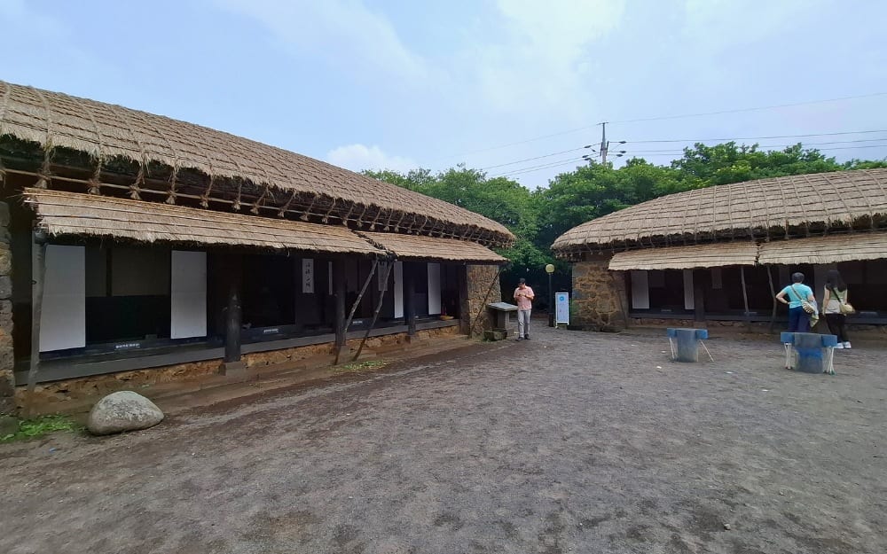
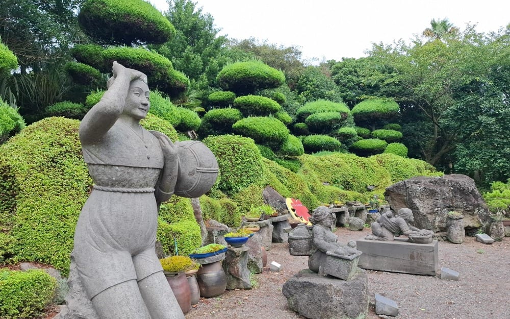
Other attractions in Ilchul Land, where Micheon Cave is located, are botanical gardens, a replica of a traditional village, and outdoor sculptures.

On the left is a replica of the inner quarters, a family's residential space where all family events from birth to death are held. It has a bedroom, hall, shed, kitchen, and pantry; and is normally not open to guests. On the right are the outdoor quarters, which accommodate the house's male head and guests.

Ilchul Land
Christa I. De La Cruz

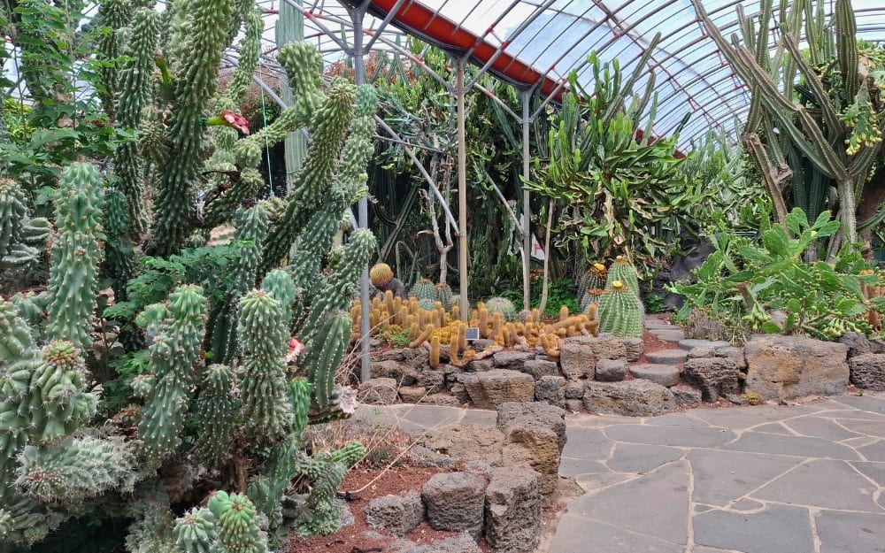
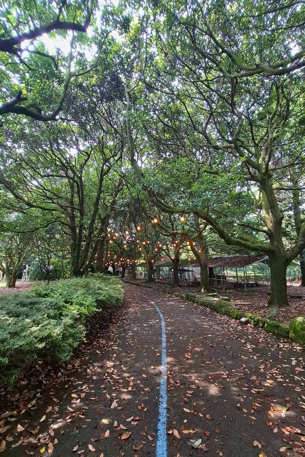
Ichulland's botanical garden, features outdoor sculptures, a cactus greenhouse, and camellia trees indigenous to Jeju Island.

Ichulland Sculptures
Christa I. De La Cruz

Ichulland Cactus
Christa I. De La Cruz

Ichulland Camellia
Christa I. De La Cruz

Ilchul Land is in Jungsangandong-ro, Seogwipo-si, Jeju-do. It is open from 8:30 a.m. to 7 p.m.

article big image
Seongsan Ilchulbong
PHOTO: Adobe Stock

Seongsan Ilchulbong

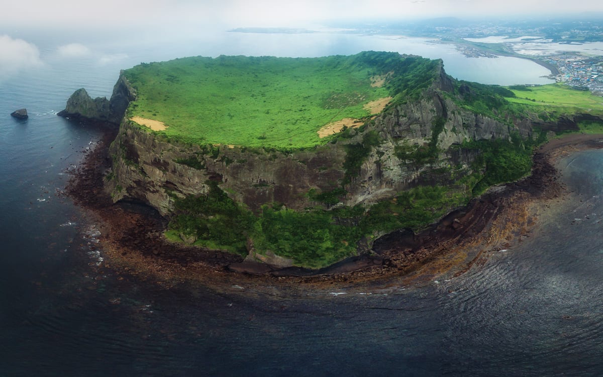
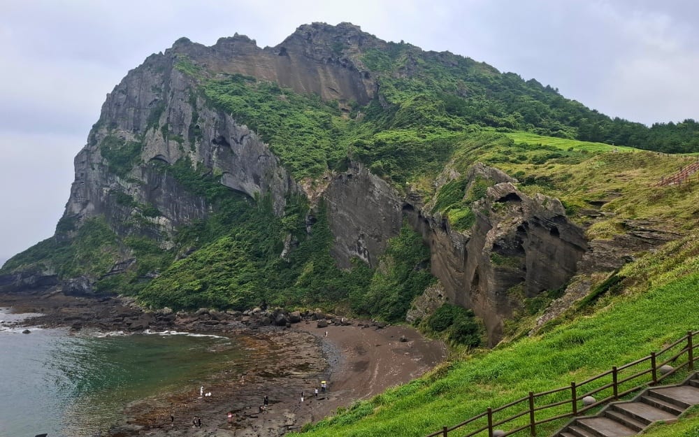
Seongsan Ilchulbong is also aptly known as the Sunrise Peak, a name derived from its eastern location, which affords one of Jeju's most magnificent sunrise views. This tuff cone, listed as part of the UNESCO World Heritage Site Jeju Volcanic Island and Lava Tubes, is believed to have been formed around 6,700 years ago by hydrovolcanic activity on a shallow seabed, making it unique from most of Jeju's parasitic volcanic cones (oreums) like the Suwolbong. Though it was originally a separate island, natural sedimentation eventually connected it to the main landmass of Jeju. Today, the peak stands at 182 meters, crowned by a preserved, bowl-shaped grassy volcanic crater.

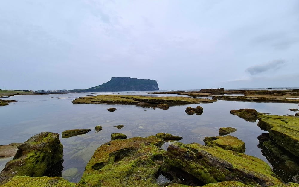
For a breathtaking view of this geological wonder, you can head to Gwangchigi Beach, located right at the crossroads of Jeju Olle Trail Routes 1 and 2. That landscape of frozen lava covered with green moss and the tuff cone in the background is like no other.

Gwangchigi Beach with the Seongsan Ilchulbong in the background

Gwangchigi Beach
Christa I. De La Cruz

To be closer to the summit, you need to go to the Seongsan Ilchulbong Marine Provincial Park, an outdoor tourist attraction with ticketed areas, paved walkways, stairways with handrails, food stalls, rest areas, and parking spaces.

Umutgaehaebyeon Beach with the Seongsan Ilchulbong behind it

Umutgaehaebyeon Beach
Christa I. De La Cruz

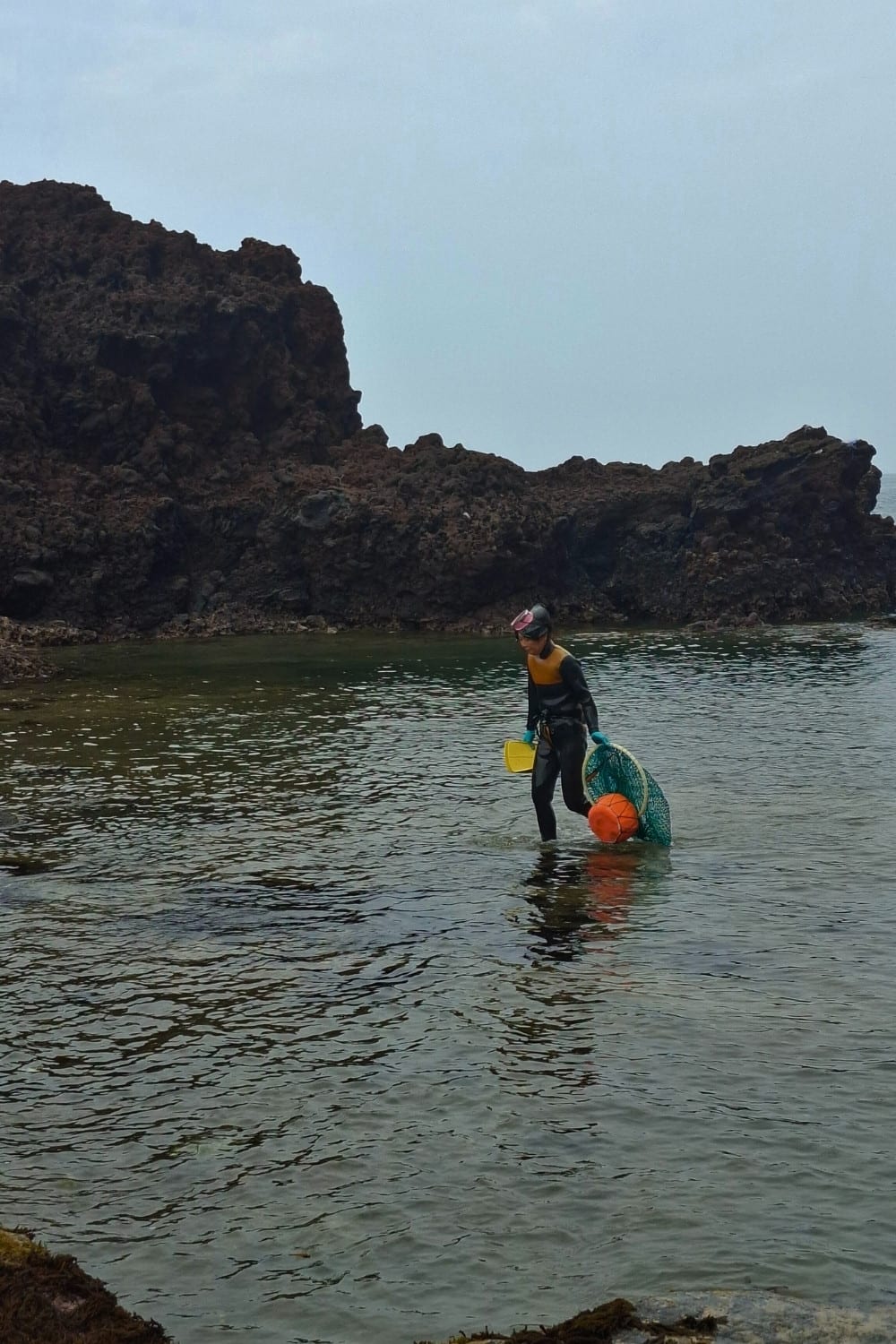
On one side is the Umutgaehaebyeon Beach, where the haenyeo (a community of women divers with some aged in their 80s) put up a show of their traditions and skills in diving 10 meters under the sea to gather shellfish. The Culture of Jeju Haenyeo was inscribed in 2016 on the Representative List of the Intangible Cultural Heritage of Humanity.

The Jeju haenyeo (female divers) harvest underwater for up to seven hours a day. They gather abalone and sea urchins just by holding their breath for one minute in every dive.

Women divers of Jeju
Christa I. De La Cruz

You can also walk to the observation deck for a view of Udo Island, which was produced by the interaction of magma and groundwater, producing a horseshoe-shaped tuff cone called the Someori Oreum.

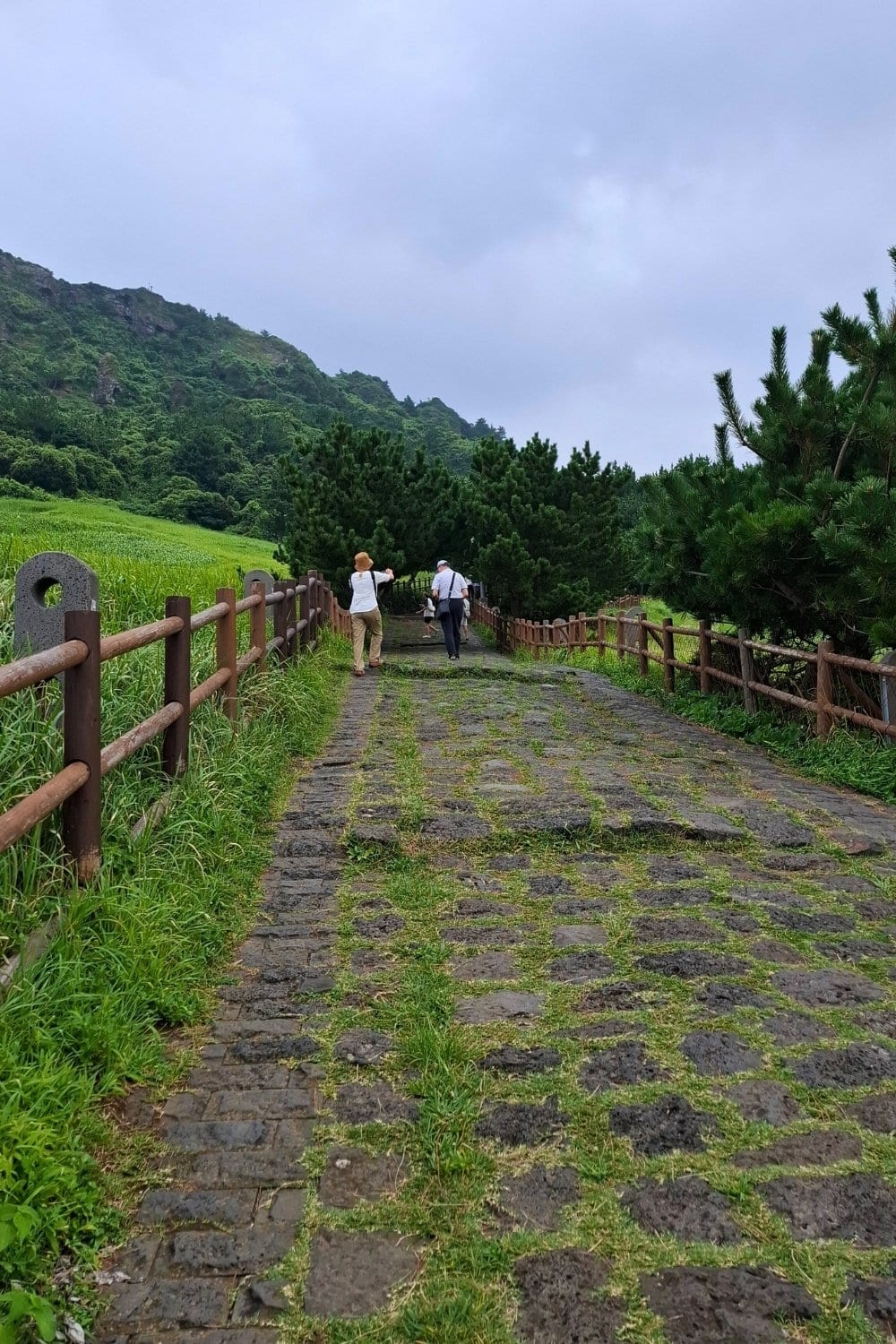
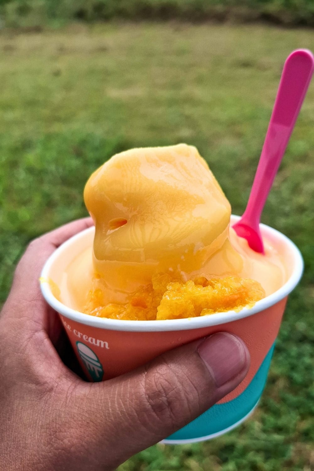
But, if your legs and lungs are up for it, you can also follow the trail all the way to the summit of Seongsan Ilchulbong. Otherwise, a cup of hallabong (tangerine) ice cream is your best bet to beat the heat if you're visiting in August.

The trail leading to the summit of Seongsan Ilchulbong can be challenging on a hot and humid summer day.

Trail to peak
Christa I. De La Cruz

Alternatively, you can just enjoy a cup of hallabong ice cream (3,000 won) and take in the view from the benches.

Tangerine Ice Cream
Christa I. De La Cruz

Seongsan Ilchulbong Marine Provincial Park is in Seongsan-ri, Seongsan-eup, Seogwipo-si, Jeju-do. It is open daily from 8 a.m. to 5 p.m.

article big image
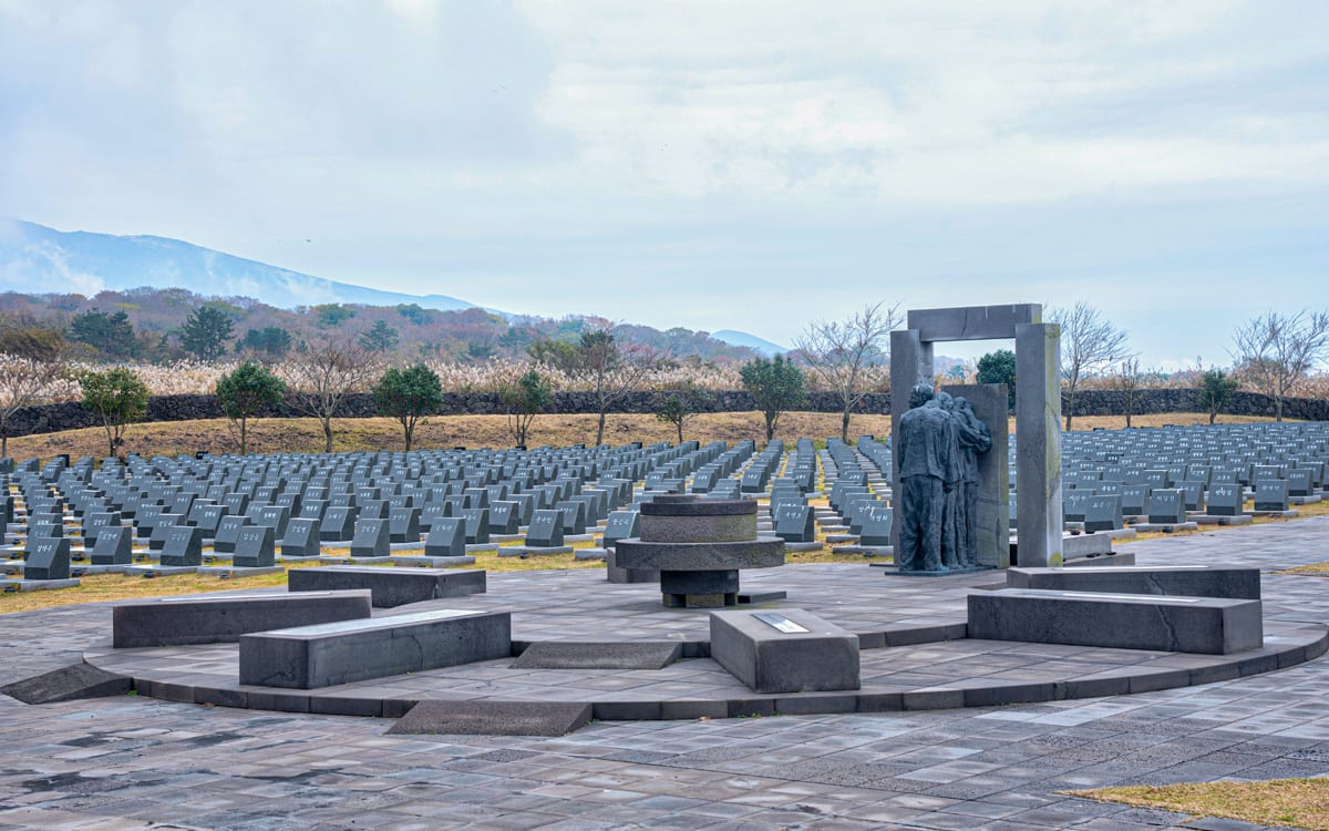
Symbolic graves of those who were killed by the military during seven years of oppression, Jeju April 3rd Uprising and Massacre
PHOTO: Adobe Stock

The Fire of Destruction

While the island’s physical features are a timeless testament to fire as a force of creation, Jeju’s history is scarred by a different kind of devastating flame.

This tragic chapter is known as the Jeju 4.3 Uprising and Massacre (1947–1954), a brutal period of political violence rooted in the immediate aftermath of Korea's liberation from Japan. The primary catalyst was the islanders’ fierce opposition to the U.S.-backed plan for a separate election in May 1948, which they feared would permanently solidify the division of the Korean peninsula. When armed resistance broke out on April 3, 1948, it was a response to escalating political tensions, police brutality, and economic distress.

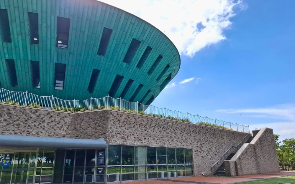
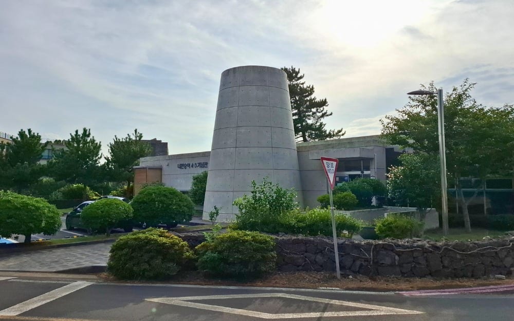
The Jeju 4.3 Peace Park in Bonggae-dong features exhibition halls that chronicle the historical events leading up to and following the Jeju 4.3 Uprising and Massacre.

Peace Park facade
Christa I. De La Cruz

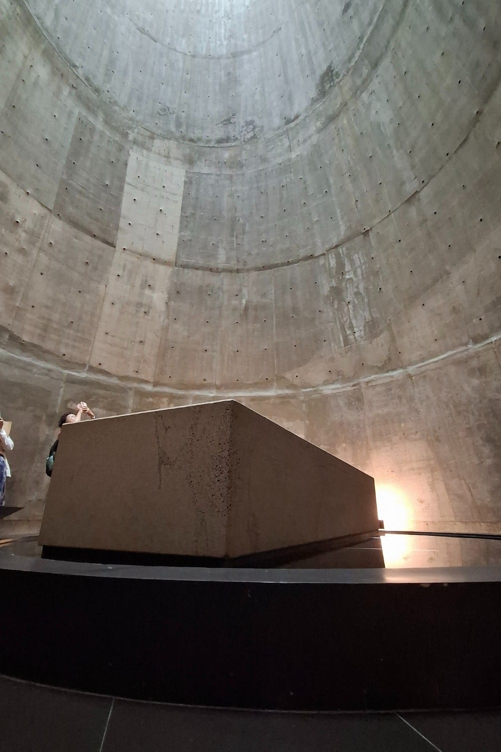
The 'Unnamed Monument'

Unnamed Monument
Christa I. De La Cruz

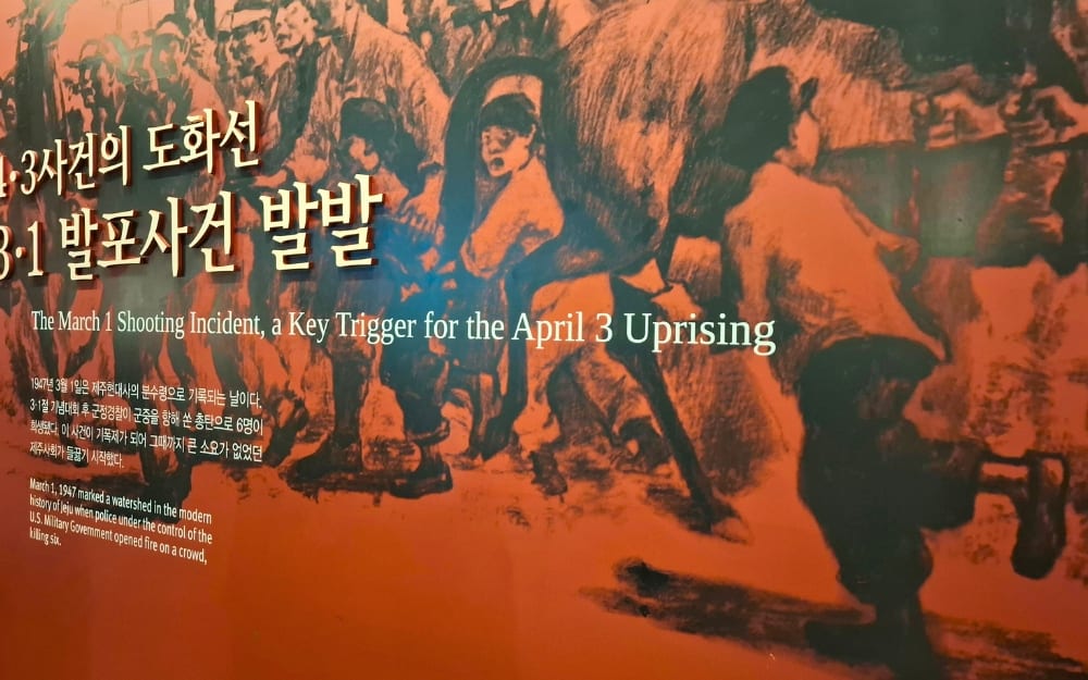
This rebellion was compounded by deep-seated resentment over local police firing upon civilians during the March 1, 1947, independence demonstration (the Anniversary of the Independence Day Movement of March 1, 1919). That afternoon, at around 2 p.m., a boy was run over by a police officer on a horse. He never stopped to look at the injured boy. Outraged, the people threw stones at the officer, and the uniformed men retaliated with gunshots. Six civilians were killed and eight were injured that day. Most of them were shot from behind, indicating that the police shot at people who were running. Among those killed was a woman carrying a baby. No one knew then that this would trigger the April 3rd Uprising.

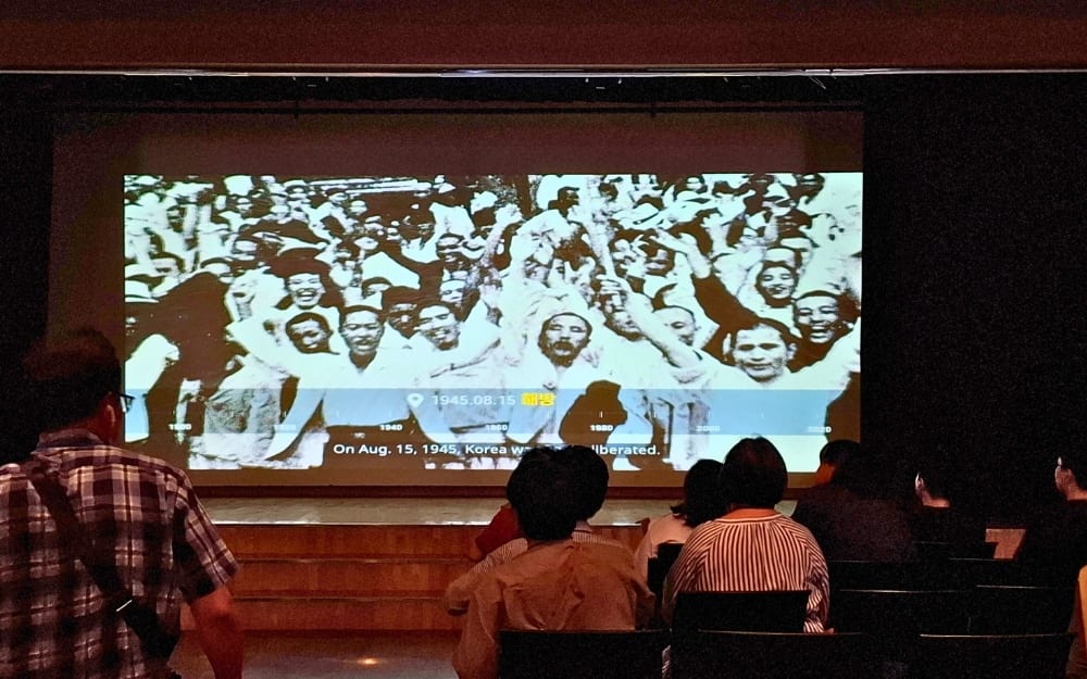
Peace Park film viewing
Christa I. De La Cruz

Peace Park exhibition
Christa I. De La Cruz

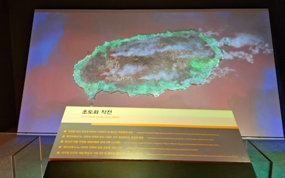
To add to that, in the context of the nascent Cold War, the resistance was framed by the mainland Rhee Syngman regime (1948 to 1960) and U.S. military authorities as a purely communist insurgency aimed at sabotaging the birth of South Korea. The government launched a severe counterinsurgency campaign, and due to the strong presence of resistance, Jeju was officially designated the "Island of Reds." The same earth that had birthed Hallasan was now consumed by a different kind of destructive force: the "Scorched Earth Operation." Whole mountain villages were burned and razed to the ground, with around 39,000 houses turned to ash and around 90,000 residents becoming refugees and suffering from starvation and cold weather. Up to a third of the victims were elderly, women, and children. The total number of victims of the Jeju 4.3 Massacre was between 25,000 and 30,000, which was about 1/10 of the total population of Jeju.

The Scorched Earth Operation was carried out by the government.

Peace Park scorched earth
Christa I. De La Cruz

These tragic memories were buried in silence for a long time as most of those who were responsible for the killings remained in power. Under decades of military-backed, anti-communist regimes, the entire incident was officially censored, repressed, and labeled as communist riots. Survivors internalized their trauma amid a climate of fear.

It wasn't until the June Democratic Uprising in 1987 that activists, scholars, and local journalists were finally able to break the silence and begin the process of unearthing the long-suppressed truth. On April 3, 1989, people held a commemoration ceremony for the first time. In 2000, the "Special Act on Discovering the Truth of the Jeju 4.3 Incident and the Restoration of Honor of Victims" was passed. In 2003, the government made an official apology, with President Roh Moo-hyun saying, "I, as the President, holding the responsibility of government, accept the Committee's suggestion and truly extend my official apology for the wrongdoings of those national authorities in the past." In 2014, the Park Geun-hye administration officially designated April 3rd as the National Day of Commemoration.

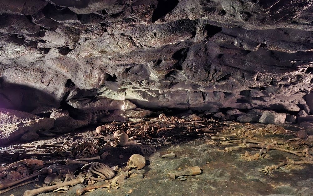
On December 18, 1948, soldiers discovered a small cave in Darangshi where refugees had taken shelter. They threw hand grenades into the cave and suffocated the surviving refugees to death by making a fire in the cave's mouth. The cave, the story, and 11 dead bodies were discovered only in 1992. The victims' remains were burnt to ashes and scattered upon the sea, despite public opinion to bury them in an open space.

Peace Park Cave
Christa I. De La Cruz

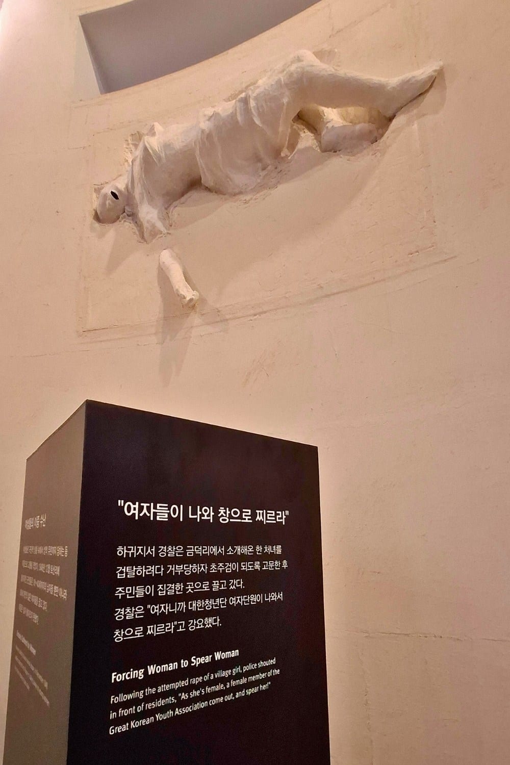
Women abuse
Christa I. De La Cruz

Today, several memorial sites are dedicated to peace and historical truth. Non-governmental organization Dark Tours holds walkthroughs and tour packages to historical sites all over the island. A good starting point is the Jeju 4.3 Peace Park, which provides a comprehensive timeline of events that led to the uprising and all the other state-sponsored massacres.

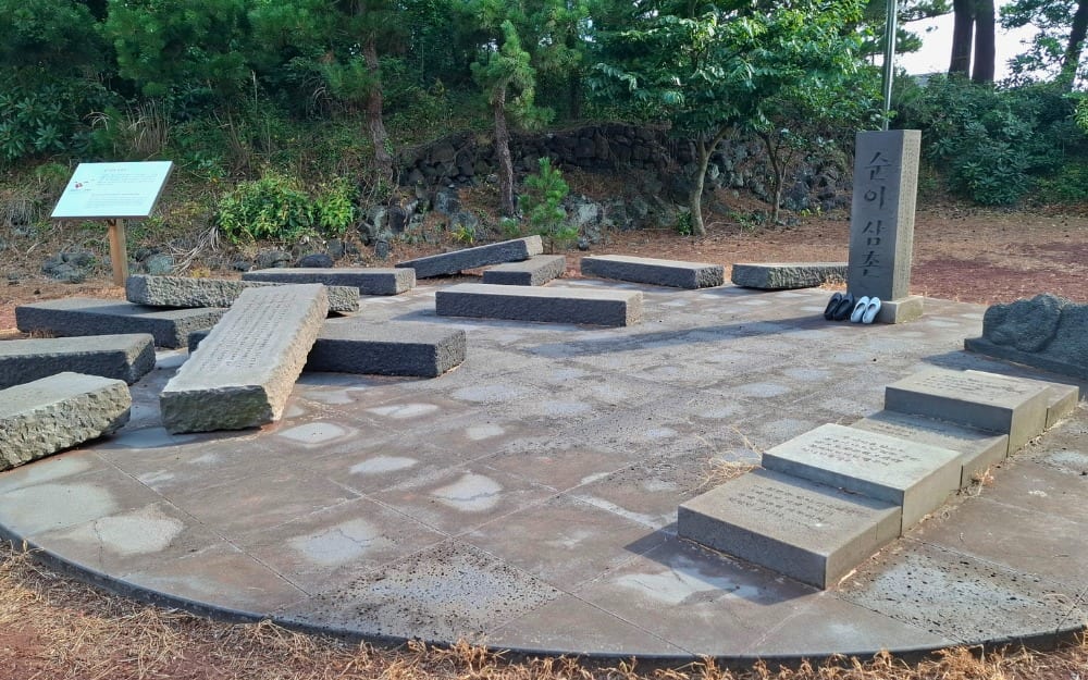
The Bukchong Neobeunsungee Memorial Hall marks the site of one of the deadliest massacres of the Uprising. Approximately 500 villagers, including children, were killed by soldiers.

Bukchong Neobeunsungee Memorial Hall

Bukchong Memorial Hall
Christa I. De La Cruz

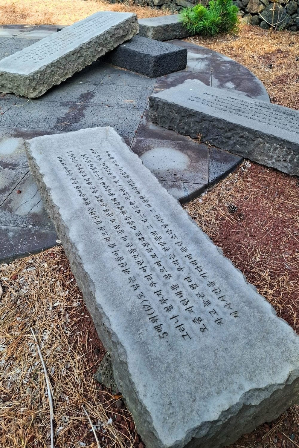
At the Neobeunsungee Historical Site, tombstones are laid on red scoria soil to symbolize the brutality and bloodshed of the Jeju April 3rd Incident.

Bukchong Memorial Hall tombstones of children
Christa I. De La Cruz

Bukchong Memorial Hall tombstones
Christa I. De La Cruz


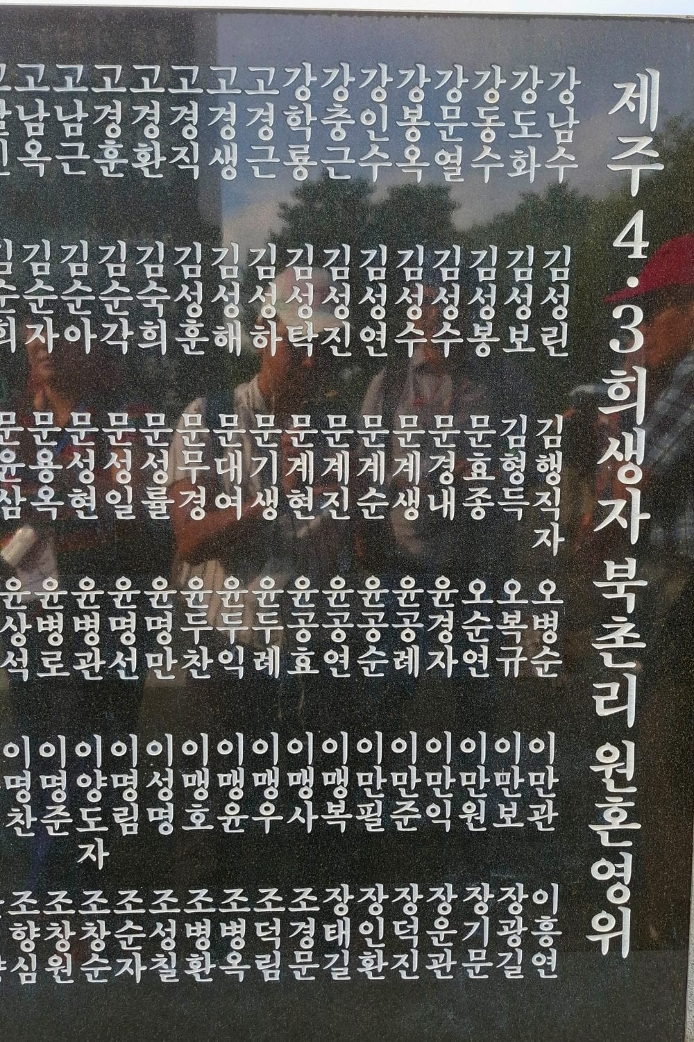
The list of names shows that whole families were killed that day in Bukchon-ri.

Bukchong Memorial Hall names
Christa I. De La Cruz


Much like how the hot lava from millions of years ago has cooled, the fire that consumed Jeju during the 4.3 Uprising has also settled. But the collective memory rages on with a vow: never forget.

Visa-free travel to Jeju Island is available for Philippine passport holders, as long as you don't pass through mainland South Korea, such as Seoul (Incheon or Gimpo Airports), Busan, or any other city. You can book a flight to Hong Kong, Singapore, or Taiwan as a transit point; then to Jeju International Airport.

All-inclusive day tours for either the southwestern part or the eastern part of Jeju Island are available through Klook (around P3,000). Tours on the Jeju April 3rd Uprising and Massacre and other moments in history are facilitated by Jeju Dark Tours.

More from esquire

Read Next
There’s a Reason The Funny Lion Resort is the Top-Rated Resort in El Nido, Palawan
Read more stories about
  • travel,
  • south korea,
  • asia,
  • international,
  • lch-00171,
  • Jeju Island
Most Shared
by author
Esquire Money
Most Popular
Latest Feed
The New Dean of New York University's Faculty of Arts and Science Is a Filipino
Armscor CEO Martin O. Tuason Passes Away at 51
A Fond Farewell to Chocolate Lover Inc.
The 8-Ball of Greatness in Philippine Pool
Tom Cruise Wore an Extremely Rare £70,000 'President' Rolex Watch to Accept His First Oscar
What Can Poetry Teach Us about Natural Disasters?
#InTheLoop
  • Politics
  • Culture
  • MONEY
  • Style
  • Long Reads
© EsquireMag.ph, All Rights Reserved.
  • About Us
  • Contact Us
  • Terms of Use
  • Privacy Policy
  • Sitemap
Close

We use cookies to ensure you get the best experience on Esquiremag.ph. By continued use, you agree to our privacy policy and accept our use of such cookies. Find out more here.

Present
Read Cover Story
Read Cover Story
Catfish Image